Research focus

  • Remote Sensing: Application of remote sensing instruments for snow and avalanche research and research on alpine mass movements
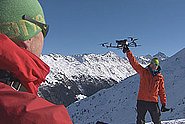
  • Drones: Unmanned Aerial Systems (UAS) in high alpine terrain
  • Large scale avalanche mapping
  • spatial continuous Snow depth mapping
  • RAMMS: Rapid Mass Movement Simulation
  • Large Scale Hazard Indication Mapping RAMMS::LSHIM
  • International scientific collaboration: India, Uzbekistan, Kirgizstan, New Zealand, Turkey, Alaska ...
  • Member Swiss Commission for Remote Sensing SCRS SCNAT

Education and training

Projects

In this project we develop and combine cutting-edge remote sensing technology with snow depth distribution and RAMMS avalanche modelling. With this we want to improve the decision base for road safety in the Dischma valley in Davos.

In this project, funded by the Swiss Agency for Development Cooperation (SDC / DEZA), we propose to apply large scale hazard indication mapping algorithms to the Himalayan province of Uttarakhand. Our goal is to identify unstable rock/ice masses and perform thermo-mechanical simulations - at the large-scale - to predict the danger of rock/ice avalanches, such as the recent event in Chamoli.

Remote sensing data – in particular optical and radar imagery – are a powerful tool to monitor the evolution of alpine mass movements. In this project, we investigate how these tools can support regional-scale hazard mitigation and improve our understanding of the processes driving slope instabilities in alpine terrain.

Comprehensive satellite data, for smaller areas also drone images, with high resolution are well suited for the documentation of avalanche periods. For a (near-) realtime use the SLF is working on automating the mapping.

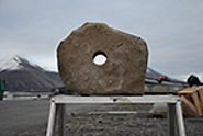
The SLF has developed software capable of simulating rockfalls. The computer model is being continuously aligned more closely with reality by way of experiments, such as those recently conducted on Spitsbergen.

The latest results prove it: snow depths can be captured efficiently and inexpensively in the mountains by using drones. This technology opens new doors in the field of snow research.

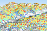
Large scale avalanche hazard indication maps for Graubünden and Liechtenstein.

Rockfalls, debris flows and rockslides are gravitational mass movements that occur frequently in the mountains. Several SLF research groups are jointly developing methods to detect potential instabilities as early as possible.

Information on large scale snow depths is still mainly based on interpolated point measurements. New developments in sensor – and software technology for digital photogrammetry in the last two decades offer new possibilities to derive high resolution, digital surface models (DSM) even over snow covered high-alpine regions.

Publications

Dash R.K., Bartelt P., Zhuang Y., Bühler Y., Kanungo D.P. (2025) Recent rock avalanche event of July 10, 2024, near Patalganga Langsi Tunnel on the Badrinath Highway of Chamoli district, Uttarakhand, India. Landslides. 22, 255-260. doi:10.1007/s10346-024-02411-9 Institutional Repository DORA
Magnusson J., Bühler Y., Quéno L., Cluzet B., Mazzotti G., Webster C., … Jonas T. (2025) High-resolution hydrometeorological and snow data for the Dischma catchment in Switzerland. ESSD. 17(2), 703-717. doi:10.5194/essd-17-703-2025 Institutional Repository DORA

Ortner G., Michel A., Spieler M.B.A., Christen M., Bühler Y., Bründl M., Bresch D.N. (2025) A novel approach for bridging the gap between climate change scenarios and avalanche hazard indication mapping. Cold Reg. Sci. Technol. 230, 104355 (23 pp.). doi:10.1016/j.coldregions.2024.104355 Institutional Repository DORA

Ruttner P., Voordendag A., Hartmann T., Glaus J., Wieser A., Bühler Y. (2025) Monitoring snow depth variations in an avalanche release area using low-cost lidar and optical sensors. Nat. Hazards Earth Syst. Sci. 25(4), 1315-1330. doi:10.5194/nhess-25-1315-2025 Institutional Repository DORA

Sykes J., Haegeli P., Atkins R., Mair P., Bühler Y. (2025) Development of operational decision support tools for mechanized ski guiding using avalanche terrain modeling, GPS tracking, and machine learning. Nat. Hazards Earth Syst. Sci. 25(3), 1255-1292. doi:10.5194/nhess-25-1255-2025 Institutional Repository DORA

Bachmann O., Foubert A., Dèzes P., Hetényi G., Jäggi A., Müntener O., … Zeyen N. (2024) Geosciences community roadmap 2024. Update of Swiss community needs for research infrastructures 2029–2032. (Swiss Academies reports, Report No.: 19/8). Swiss Academy of Sciences (SCNAT). 36 p. doi:10.5281/zenodo.14264991 Institutional Repository DORA

Bartelt P., Stoffel L., Christen M., Bühler Y. (2024) Grain flow theory and snow avalanche rheology. In K. Gisnås, P. Gauer, H. Dahle, M. Eckerstorfer, A. Mannberg, & K. Müller (Eds.), Proceedings of the international Snow Science Workshop 2024. Oslo: Norwegian Geotechnical Institute. 360-365. Institutional Repository DORA

Bartelt P., McArdell B., Bühler Y., Graf C. (2024) Zweiphasenmodellierung von Murgängen für die Überprüfung von Schutzmassnahmen. In I. Schalko, D. Farshi, & A. Badoux (Eds.), WSL Berichte: Vol. 155. Fachtagung Wildbäche 2024: Modellierung von Wildbachprozessen. Birmensdorf: Eidg. Forschungsanstalt für Wald, Schnee und Landschaft WSL. 49-58. doi:10.55419/wsl:37776 Institutional Repository DORA

Bühler Y., Stoffel A., Liechti D. (2024) Where to put the weather station? Optimizing the location for automated snow depth measurements based on remote sensing, avalanche modeling and terrain characteristics. In K. Gisnås, P. Gauer, H. Dahle, M. Eckerstorfer, A. Mannberg, & K. Müller (Eds.), Proceedings of the international Snow Science Workshop 2024. Oslo: Norwegian Geotechnical Institute. 1054-1060. Institutional Repository DORA

Fergus Dal J., Hafner E.D., Peters T., Narnhofer D., Caye Daudt R., Heisig H., Bühler Y. (2024) Automated snow avalanche mapping with deep learning in aerial imagery from the extreme avalanche winter of 1999. In K. Gisnås, P. Gauer, H. Dahle, M. Eckerstorfer, A. Mannberg, & K. Müller (Eds.), Proceedings of the international Snow Science Workshop 2024. Oslo: Norwegian Geotechnical Institute. 1264-1271. Institutional Repository DORA

Glaus J., Wikstrom Jones K., Kleinn J., Stoffel L., Ruttner-Jansen P., Gaume J., Bühler Y. (2024) Probability-based avalanche run-out mapping for road safety. In K. Gisnås, P. Gauer, H. Dahle, M. Eckerstorfer, A. Mannberg, & K. Müller (Eds.), Proceedings of the international Snow Science Workshop 2024. Oslo: Norwegian Geotechnical Institute. 860-867. Institutional Repository DORA

Hafner E.D. (2024) Automated avalanche mapping with deep learning: from satellite to webcam imagery. [Doctoral dissertation] ETH Zurich. 139 p. Institutional Repository DORA

Hafner E.D., Kontogianni T., Daudt R.C., Oberson L., Wegner J.D., Schindler K., Bühler Y. (2024) Interactive snow avalanche segmentation from webcam imagery: results, potential, and limitations. Cryosphere. 18(8), 3807-3823. doi:10.5194/tc-18-3807-2024 Institutional Repository DORA

Hafner E.D., Techel F., Heisig H., Dal J.F., Bühler Y. (2024) Remotely sensed avalanche activity during three extreme avalanche periods in Switzerland. In K. Gisnås, P. Gauer, H. Dahle, M. Eckerstorfer, A. Mannberg, & K. Müller (Eds.), Proceedings of the international Snow Science Workshop 2024. Oslo: Norwegian Geotechnical Institute. 1222-1229. Institutional Repository DORA

Harvey S., Christen M., Bühler Y., Hänni C., Boos N., Bernegger B. (2024) Refined Swiss avalanche terrain mapping CATv2 / ATHv2. In K. Gisnås, P. Gauer, H. Dahle, M. Eckerstorfer, A. Mannberg, & K. Müller (Eds.), Proceedings of the international Snow Science Workshop 2024. Oslo: Norwegian Geotechnical Institute. 1637-1644. Institutional Repository DORA

Helbig N., Mott R., Bühler Y., Le Toumelin L., Lehning M. (2024) Snowfall deposition in mountainous terrain: a statistical downscaling scheme from high-resolution model data on simulated topographies. Front. Earth Sci. 11, 1308269 (19 pp.). doi:10.3389/feart.2023.1308269 Institutional Repository DORA

Kleinn J., Bühler Y., Glaus J., Aller D., Berger C., Rinderer M., … Singeisen C. (2024) A probability-based modelling approach beyond a few selected return periods for comprehensive and robust hazard and risk assessment. In K. Gisnås, P. Gauer, H. Dahle, M. Eckerstorfer, A. Mannberg, & K. Müller (Eds.), Proceedings of the international Snow Science Workshop 2024. Oslo: Norwegian Geotechnical Institute. 841-847. Institutional Repository DORA

Kyburz M.L., Sovilla B., Bühler Y., Gaume J. (2024) Potential and challenges of depth-resolved three-dimensional MPM simulations: a case study of the 2019 "salezer" snow avalanche in Davos. Ann. Glaciol. 65, e19 (14 pp.). doi:10.1017/aog.2024.14 Institutional Repository DORA

Manconi A., Bühler Y., Stoffel A., Gaume J., Zhang Q., Tolpekin V. (2024) Brief communication: monitoring impending slope failure with very high-resolution spaceborne synthetic aperture radar. Nat. Hazards Earth Syst. Sci. 24(11), 3833-3839. doi:10.5194/nhess-24-3833-2024 Institutional Repository DORA

Munch J., Bühler Y., Zhuang Y., Manconi A., Bartelt P. (2024) Understanding flow transitions in multi-component avalanches. In J. Schneider (Ed.), Interpraevent 2024. Conference proceedings. Klagenfurt: Interpraevent. 138-143. Institutional Repository DORA

Show all
×