30.07.2024 | Jochen Bettzieche | SLF News
This winter, the SLF tested a new system to better assess the risk of avalanches to traffic routes. The results are promising and should allow roads and railroad lines to be closed for shorter periods of time in the future when conditions are tight.
This text was automatically translated.
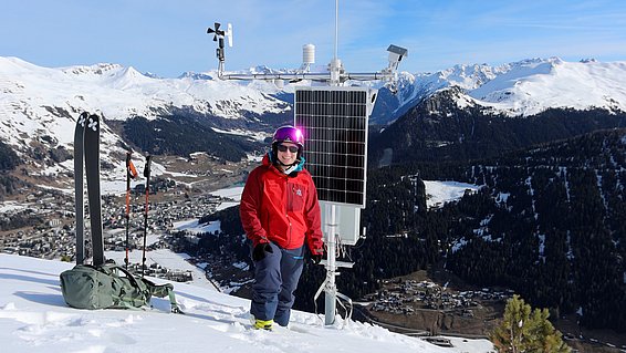
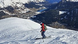
Early morning at the beginning of April in Davos: Pia Ruttner-Jansen swings down the ski slope at Brämabüel - then suddenly turns right into open terrain. But not for a descent in the finest powder, because the geomatics expert is not here for fun. The SLF researcher is on her way to her measuring stations. The aim is to increase safety on mountain roads, railroad lines and ski slopes in winter. On 23 November 2023, Ruttner-Jansen and her colleagues installed two laser scanners on Brämabüel, away from the northernmost slope of the Jakobshorn ski area in Davos, one at 2255 and one at 2191 meters above sea level. She used them to monitor an avalanche slope throughout the winter.
If the system works, its results will serve as a decision-making aid in future. Up to now, the data on which those responsible decide whether to close a traffic route has only been available in isolated cases, explains Ruttner-Jansen: "The decision is usually based on weather and snow data, the avalanche bulletin and local observations and knowledge of the terrain, combined with the personal experience of those involved." Her project aims to provide a better basis with data directly from potential avalanche starting zones.
You can rely on this avalanche 
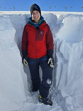
In winter, she set off to the upper measuring station several times to check on it and create snow profiles nearby. "I can't get to the lower station, the path leads through the 30 to 45 degree steep avalanche slope that we are measuring, which is too dangerous," says Ruttner-Jansen. Because you can rely on the Wildi avalanche, named after the farm of the same name, next to which the avalanche rushes past. "This avalanche actually happens several times a year," says Ruttner-Jansen. In the past, the road into the Dischma valley has had to be closed from time to time. In this case, comparatively few people are affected, as the valley is sparsely populated. The situation is different when access routes to major winter sports resorts are closed. In 2018, for example, Zermatt was cut off from the outside world for a week, with negative consequences for tourists, restaurants and hoteliers. According to Ruttner-Jansen, the total damage exceeded the million mark.
What is ... the starting zone of an avalanche?
The starting zone of an avalanche is the area in which the snow masses become detached and start to move. It is always located in steep terrain with a slope inclination of at least 30 degrees.
With her measuring stations, she can keep an eye on how the snow depths are distributed in the avalanche's starting zone (see box). This can actually also be done with the help of aerial photographs taken from an airplane or with a drone, "but we have a higher temporal resolution," says the scientist, citing the advantages of her method. This is because she measures every hour and her results are often accurate to the decimeter, sometimes even better. Another advantage is the low cost. The two stations together cost around 30,000 Swiss francs, including helicopter transportation and the wind turbine. This is also due to the LiDAR devices (see box) that Ruttner-Jansen uses. These are now standard for driver assistance systems in the automotive industry and are therefore no longer expensive. The researcher compares: "Large laser scanners usually cost over a hundred thousand Swiss francs."
What is ... LiDAR?
The abbreviation stands for light detecting and ranging. LiDAR devices emit laser pulses and measure the distance to objects and the intensity of the light beam reflected by them. This allows users to determine various parameters such as the speed of objects, but also the concentration of various gases in the atmosphere.
At the end of the 2023/24 season, she has already summarized the initial results. "The high potential of the system is already evident," says Ruttner-Jansen. Even though only one measuring system was still in place towards the end of the winter. The second, lower-lying one was overturned on April 14 by a large avalanche of sliding snow from the Wildi avalanche area. The researchers deliberately took this risk in order to obtain valuable information from the avalanche's starting area. By next fall, it should be standing again, then better protected.
Ruttner-Jansen also wants to expand her results in the coming 2024/25 season and is planning additional measuring stations at a second location: "A south-facing slope would be ideal for comparison."
Contact 
Links 
- Project: Avalanche safety for roads
Copyright 
WSL and SLF provide image and sound material free of charge for use in the context of press contributions in connection with this media release. The transfer of this material to image, sound and/or video databases and the sale of the material by third parties are not permitted.


