17.08.2023 | Jochen Bettzieche | SLF News
SLF researchers have been mapping snow depths in detail over a large area. The new technique yields important basic data.
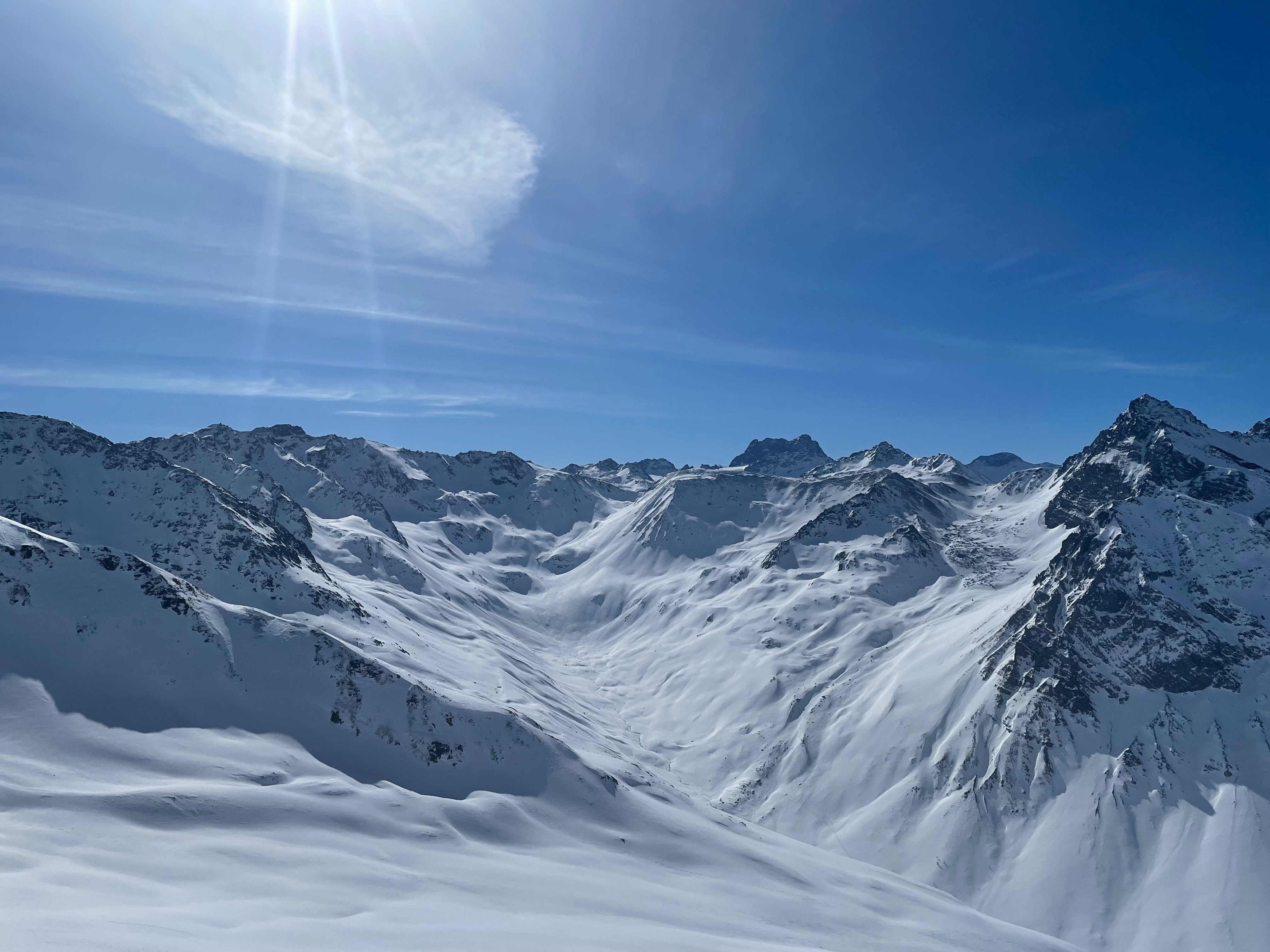
You don't always need a laser – sometimes a camera will do. Researchers at the WSL Institute for Snow and Avalanche Research (SLF) have now disproved the paradigm that the height of snowpack can only be accurately determined from the air using laser scanners, says Yves Bühler, Head of the SLF's Alpine Remote Sensing research group. "We were surprised ourselves that we were able to map snow so accurately using photos taken from a plane at very high resolution." The method is known as photogrammetry. The scientists mapped the snowpack across an area of approximately 250 square kilometres around Davos, from Klosters in the north to Piz Fourun in the south, with the Dischma Valley in the centre. The resolution was half a metre and the accuracy 15 centimetres, as shown by a comparison with measurements taken by hand and from drones.
The method saves money 
Accurate snow data is an important resource for predicting natural hazards such as avalanches and floods, as well as determining the snow load on roofs. Energy suppliers can also make use of such results. "Our data helps to improve models that show how much water there is in the snowpack," explains Bühler. This, he says, is important for the operation of hydropower plants. Researchers can also use the information to determine suitable locations for weather stations, whose measurement results they then extrapolate for the entire area.
Another advantage of the method is that it saves money. For photogrammetry, aircraft operate at an altitude of around 6,000 metres, says Bühler. "With laser scanners, they usually have to fly much lower and slower." Other approaches also have their drawbacks. Drones are only suitable for small areas of four to five square kilometres, and satellite data is not yet accurate enough.
The difference is the snow depth 
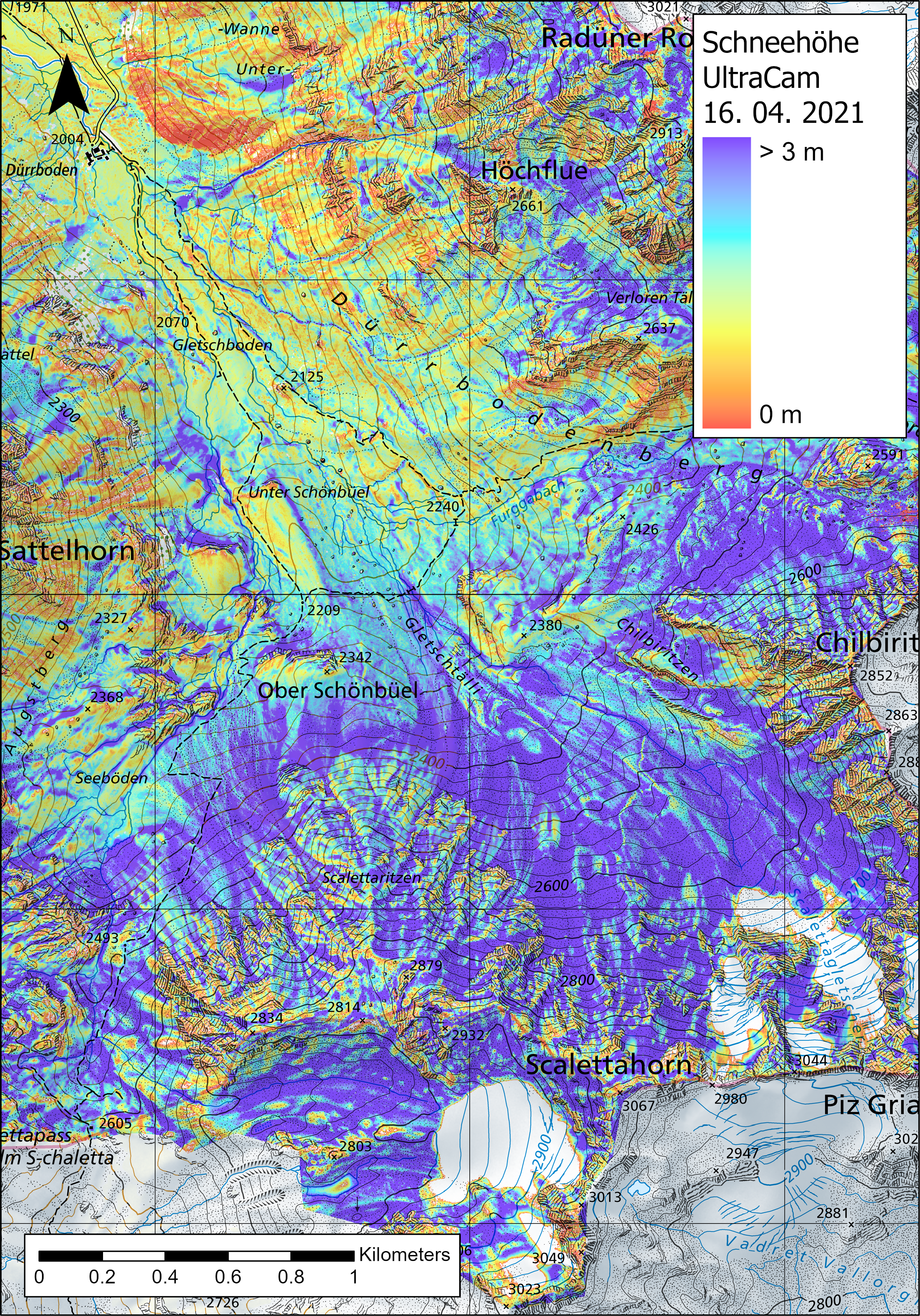
The SLF now has comprehensive snow depths for the study area from 2010 until today, forming an unparalleled long-term data set. The images were taken by Flotron, an engineering firm, on behalf of the SLF in late March and early April, the time of year when the snow at higher elevations in the Davos region is at its maximum depth. The planes were equipped with surveying cameras. "Essentially, these are conventional cameras, only with an extremely high resolution of 450 megapixels instead of the 24 megapixels found in standard devices," explains Bühler. The next step for the researchers is to subtract the heights indicated on a snow-free surface model from those on a surface model with snow cover. The difference is the snow depth.
")
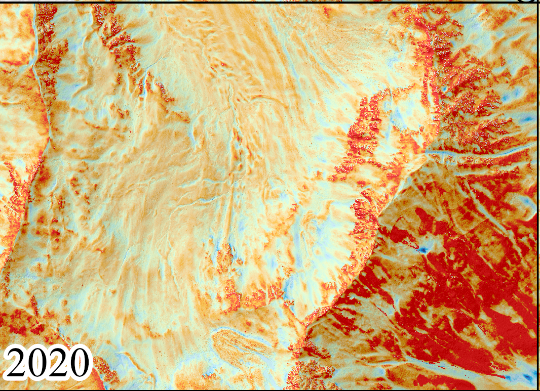
Image 1 of 2
Snow depths in the Dischma Valley in 2020 ... (Graphic: Yves Bühler / SLF)
")
Image 2 of 2
... and in the significantly snowier year 2021 (Graphic: Yves Bühler / SLF)
The measurements show that the snow depth varies from year to year, but this only applies to the absolute values. "In relative terms, the ratio of snow depth from point to point is usually very similar over the years," says Bühler. There are exceptions, though, with snow depths differing significantly between years in some cases. He cites avalanches and snow transport as possible reasons. These differences are exciting for avalanche research, and the data from Bühler's team now enables them to be analysed in detail.
")
Image 1 of 4
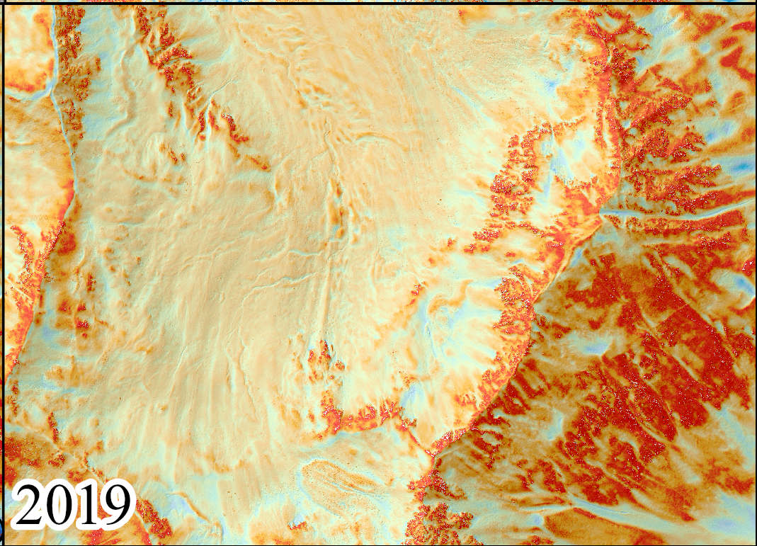
during high winter, here the year 2018, from zero percent (dark red) to more than 400 percent (dark blue). The figures highlight various special features: 1. 495 filled small streams; 2. filled runoff in steep terrain; 3. and 4. forests; 5. avalanche deposition zone (Graphic: Leon Bührle / SLF).
")
Image 2 of 4
Normalised snow depth map 2019 (Graphic: Leon Bührle / SLF)
")
Image 3 of 4
Normalised snow depth map 2020 (Graphic: Leon Bührle / SLF)
")
Image 4 of 4
Normalised snow depth map 2021 (Graphic: Leon Bührle / SLF)
The SLF will undertake further flights in Davos in the coming winters to continue this unique time series. The results obtained so far are already being used by many projects, for example to validate model calculations for the whole of Switzerland, says Bühler. "We've also already received enquiries about measuring snow depth over large areas in other regions using this method, for example in the Swiss National Park."
Quotes as audio files for download (German only) 
- Yves Bühler: "We have disproved the paradigm that the height of the snowpack can only be determined with sufficient accuracy from the air using laser scanners, we were surprised ourselves that we can map so accurately using photos from the plane ..." (wav, 3 MB)
- Yves Bühler: "Our data is now helping to improve the very models that show how much water is stored in the snowpack." (wav, 1 MB)
- Yves Bühler: "For photogrammetry, the plane is moving at around 6000 metres above sea level, with the laser scanners we would usually have to fly much lower and slower." (wav, 2 MB)
- Yves Bühler: "In principle, survey cameras like we use are conventional cameras, only with an extremely high resolution of about 450 instead of the 24 megapixels that are common in the private sector." (wav, 2 MB)
- Yves Bühler: "Relatively speaking, the ratio of snow depth from point to point is usually very similar and constant over the years." (wav, 1 MB)
- Yves Bühler: "We already have requests to measure snow depth over a large area in other regions with our method, for example in the Swiss National Park." (wav, 1 MB)
Always up to date: Subscribe to the WSL Newsletter
Contact 
Links and documents 
Copyright 
WSL and SLF provide image and sound material free of charge for use in the context of press contributions in connection with this media release. The transfer of this material to image, sound and/or video databases and the sale of the material by third parties are not permitted.