10.12.2019 | Claudia Hoffmann | News SLF
For the first time, researchers from the WSL Institute for Snow and Avalanche Research (SLF) have mapped an extreme avalanche period using optical satellite images, producing the fullest, most comprehensive data set on avalanches during an extreme period anywhere in the world.
Documenting avalanches as accurately and extensively as possible is important, e.g. for improving avalanche forecasts or reviewing hazard maps. Normally, information about avalanches comes from reports by individual observers or from helicopter overflights, but these sources cannot provide a full picture. No comprehensive mapping had been carried out previously, especially of periods characterised by exceptionally frequent and large avalanches.
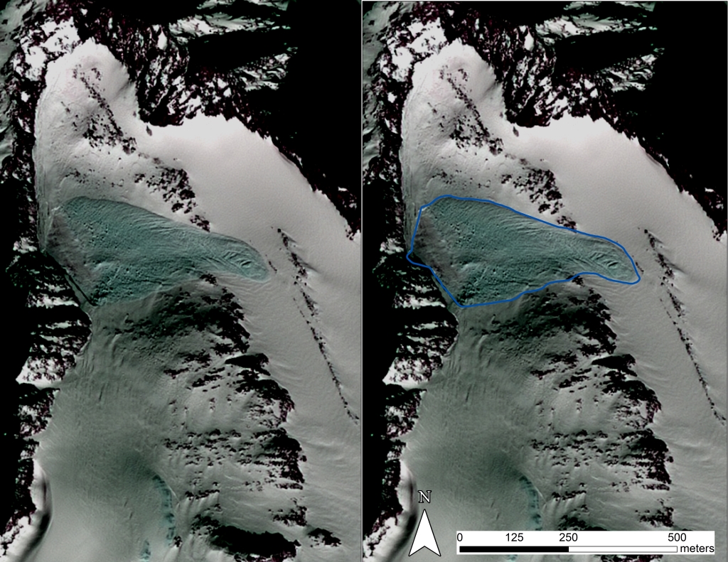
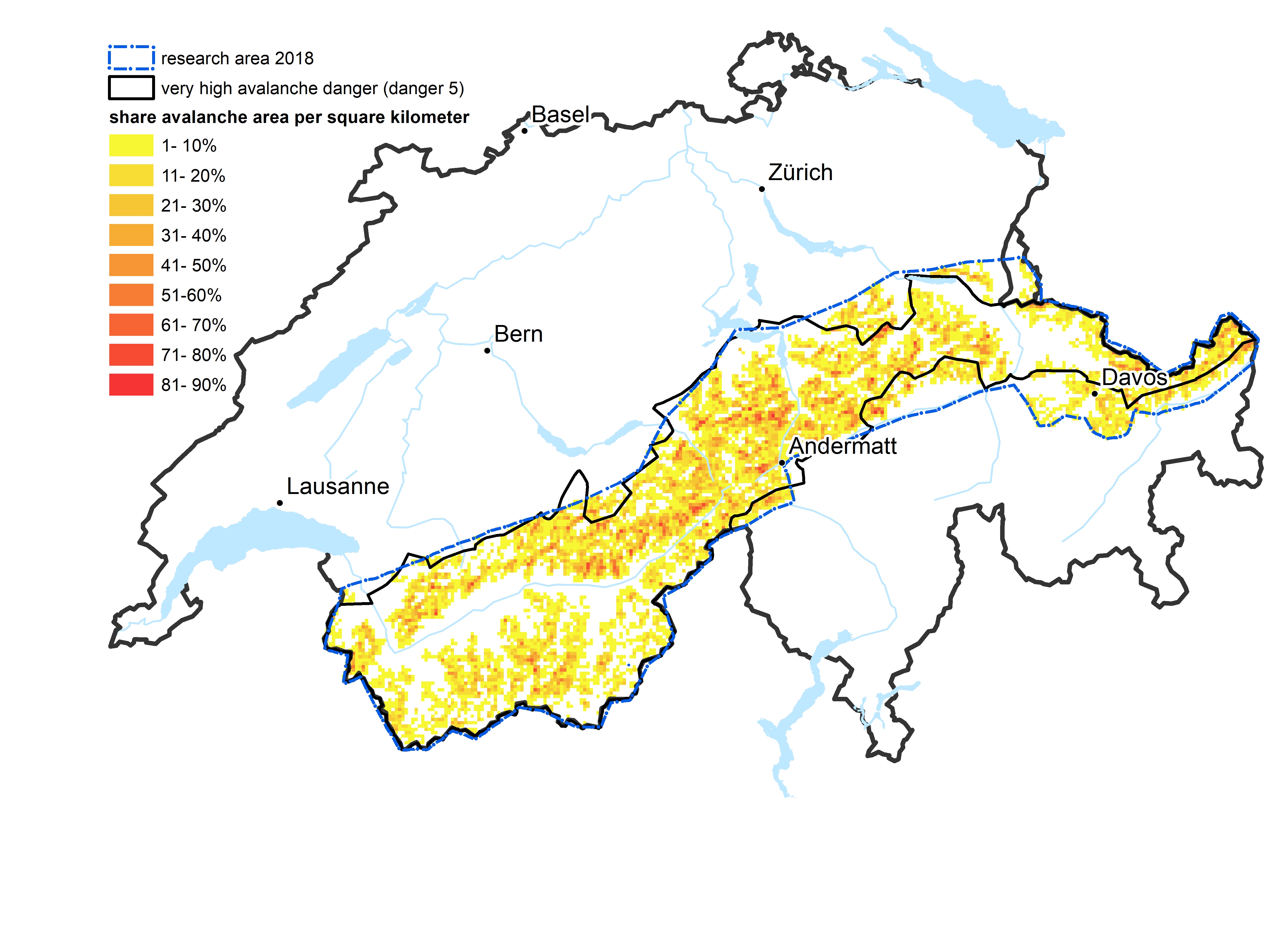
But now SLF researchers, working in collaboration with swisstopo, have for the first time tested the use of satellite data to document an extreme avalanche period. To this end, shortly after repeated heavy snowfall in January 2018, the SLF commissioned the SPOT6 satellite to record images with a resolution of 1.5 metres in the visible (red, green, blue) light spectrum and near-infrared region, covering an area of 12,500 square kilometres, i.e. most of the Swiss Alps. SLF employee Elisabeth Hafner analysed the images by hand, recording - among other things - the outlines, types and sizes of all detectable avalanches, 18,737 in total. This work was part of the 2018 event analysis, the findings of which have now also been published in the journal "The Cryosphere".
Suitable for mapping large areas 
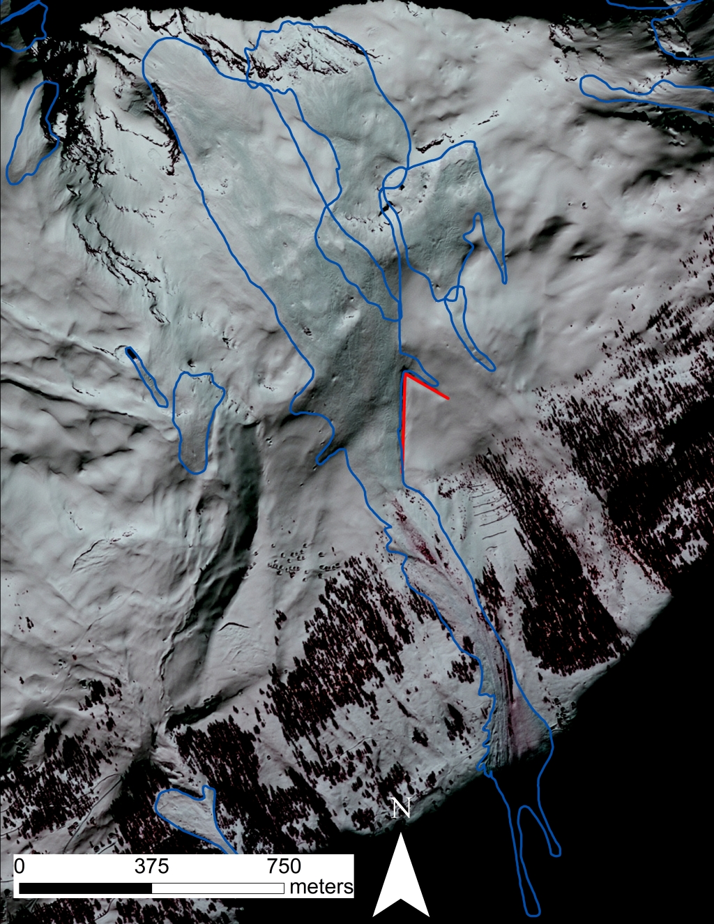
To check whether the outlines of avalanches on the satellite images had been correctly identified, the researchers compared a sample with photographs taken during helicopter overflights. Hafner's conclusion? "The method is reliable and suitable for the large-scale mapping of extensive areas". The captured data will now be incorporated into the SLF's avalanche cadastre and other databases and will help, among other things, to test the effectiveness of protection measures taken after previous avalanche winters. The satellite images also afford an overview of resulting forest damage and serve to check danger levels forecast in the avalanche bulletin and improve avalanche simulation models such as RAMMS.
The satellite mapping was repeated in the January 2019 avalanche period, and may be used again during future extreme events. However, it has so far proved a labour-intensive process, with the outlines of individual avalanches having to be drawn by hand on the satellite images. For this reason, a master's thesis will investigate the potential for at least partially automating the mapping procedure. In addition, in collaboration with the Earth Observation and Remote Sensing Group at ETH Zurich's Institute of Environmental Engineering, the SLF is exploring the possibility of mapping avalanches by radar satellite. Radar satellites have the advantage of being weather-independent since they can take pictures even when the sky is overcast. Initial results are promising.
Contact 
Publications 
Copyright 
WSL and SLF provide the artwork for imaging of press articles relating to this media release for free. Transferring and saving the images in image databases and saving of images by third parties is not allowed.