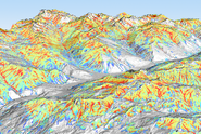
Between January 6 and 15, 2019, South Tyrol, Italy, experienced a series of remarkably large and infrequent powder snow avalanches, marking some of the most significant occurrences in the region over the past five decades. These avalanches, characterized by their immense scale, decimated 200-year-old trees, left alpine huts in ruins and destroyed avalanche protection structures. Fortunately, no human casualties were reported. The relentless snowfall, which persisted for 17 days, was exacerbated by persistent northwesterly winds at high altitudes, resulting in an accumulation of 1.3 to 2.5 meters of new snow above the timberline along the eastern main ridge of the Alps. With consistently low temperatures in the first half of January and the lingering effects of unfavorable snow cover from early winter, the avalanche threat intensified. Several large avalanches occurred on January 14, when the perilous conditions escalated to an avalanche danger level of 4 along the northern border ridge with Austria. In nearby regions of Tyrol, Austria, the avalanche danger level reached 5.
In this paper, we compare 100-year calculation scenarios with an extreme powder snow avalanche from 2019. Our goal is to test existing hazard mapping procedures to determine how advanced avalanche dynamics models can be effectively employed to predict extreme avalanche hazards. Rather than backcalculating the documented avalanche, we adopt the approach of a hazard engineer who must construct a hazard map without reference data, relying mainly on historical snow and weather data from the region. We conclude that it is possible to expand existing avalanche calculation procedures that utilize statistical extreme value snow cover data to include snow temperature and snow cover distribution.
Siehe Institutional Repository DORA


